|
Pipelines construction projects presents special challenges such as permitting, land acquisition, crossings, equipment - move around and maintain crew separation. . |
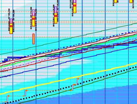
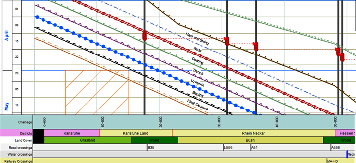
TILOS is a scheduling system based on a time-distance diagram. This means that it can connect on the distance axis the alignment sheets of the ROW with the schedule and also represent on the time axis special weather conditions (like heavy rainfall, frozen land) or environmental restrictions that prevent works on a land portion for a time period.
The distance axis of the plan will be adjusted to the ROW length of pipeline.
Along the distance axis the following data can be added as a ribbon:
- Elevation
- Crossings with rivers, roads, railways, access roads
- Pipe thickness and type, pipe weight requirements, valve positions
- Stockpiles
- Road bores positions
- Pump stations positions
- Land permits and municipal districts that the pipeline is traversing

Along the time axis, weather restrictions can be marked up in order to be properly addressed when the execution plan is developed.

Each task performed by a crew is defined by the start and end coordinates in both time and location. The line between these points defines the task and describes when the crew is at a specific location.
Tasks like road bores, drills, block valves, pump station substructure, superstructure and fit-out will be represented as rectangles, because the crews are working in one location for a period of time.
Hydro test segments and access restrictions are also represented as rectangles which are clearly defined along the time and distance axis, indicating a no-access area.

Because TILOS system uses special distance lags and equipment mobilization lags when linking tasks, crews can be started sequentially in order to reduce the total construction time and also prevent one crew catching up to another. If an activity overtakes another, TILOS will indicate a clash between the tasks that needs to be resolved.
TILOS can apply speed or work-rates profiles to each crew. As the speed can depend on the soil or weather conditions, different work-rates along the ROW will result in changing the slope for the task line. Speed profiles can be imported from Excel spreadsheets in TILOS and applied to tasks.
TILOS system is visually developing the schedule summarizing important data information regarding the ROW and constructability issues and provides a realistic, feasible method for planning pipelines construction works.
CADexpert NET is a team of professionals that can provide affordable consulting, project planning and software training services to companies across multiple industries.
Contact : office@cadexpert.eu
